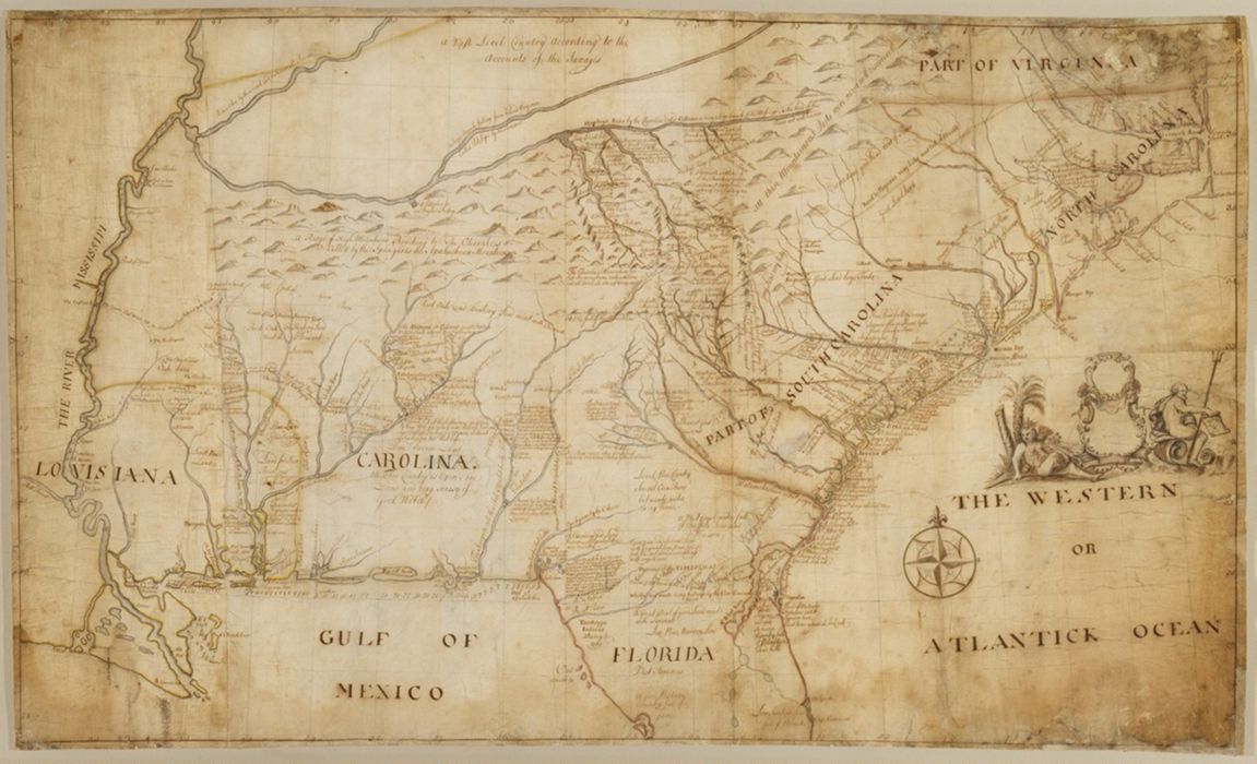
1 map : pen and black and brown ink, with red, yellow, and blue-gray wash ; 78 x 132 cm.
Collection:
Rare Books and Manuscripts
Credit Line:
Yale Center for British Art, Gift of the Acorn Foundation, Inc., Alexander O. Vietor, Yale BA 1936, President, in honor of Paul Mellon
Copyright Status:
Public Domain
Related Content:
View a selection of digital images in the Yale Center for British Art's online catalogue
https://collections.britishart.yale.edu/catalog/orbis:9600894
Classification:
Maps & Atlases (manuscript)
Scale:
Scale [ca. 1:1,150,000] -- (W 94⁰--W 74⁰/N 37⁰--N 28⁰).
Notes:
Relief shown pictorially.
Exhibition History:
Wilde Americk - Discovery and Exploration of the New World, 1500-1850 (Yale Center for British Art, 2001-09-27 - 2001-09-27)
Subject Terms:
Hammerton, William, d. 1732. | Barnwell, John, ca. 1671–1724. | Catesby, Mark, 1683–1749. Map of Carolina, Florida, and the Bahama Islands. | Popple, Henry, d. 1743. Map of the British Empire in America with the French and Spanish settlements adjacent thereto. | Mitchell, John, 1711–1768. Map of the British and French dominions in North America. | Fortification -- Southern States -- Maps -- Early works to 1800. | Human settlements -- Southern States -- Maps -- Early works to 1800. | Indians of North America -- Southern States -- Maps -- Early works to 1800. | Trade routes -- Southern States -- Maps -- Early works to 1800. | Southern States -- Maps -- Early works to 1800. | Devonshire, William Cavendish, Duke of, 1672–1729 -- Provenance.
Form/Genre:
Maps. | Watercolors. | Ink drawings.
Contributors:
Barnwell, John, approximately 1671–1724, cartographer.