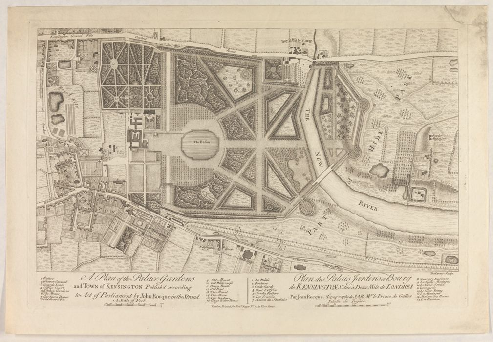
A plan of the palace gardens and town of Kensington ... = Plan du palais jardins et bourg de Kensington : situé à deux mile de Londres / par Jean Rocque ...
Published / Created:
[London] : J. Rocque, [1736?].
Physical Description:
1 map ; 28 x 48 cm., on sheet 39 x 55 cm.
Holdings:
Rare Books and ManuscriptsFolio A G 14 Copy 1Rare Books and ManuscriptsFolio B G 4 Copy 2
Copyright Status:
Public Domain
Related Content:
View a selection of digital images in the Yale Center for British Art's online catalogue
https://collections.britishart.yale.edu/catalog/orbis:584378
Classification:
Maps & Atlas (printed)
Scale:
Scale [ca. 1:4,800].
Notes:
BAC: British Art Center has 2 copies. Copy 1 is bound with: Plan de la ville et foubourgs [sic] de York / Peter Chassereau. [London] : J. Rocque, 1750. This vol. supposedly belonged to Rocque.BAC: Copy 2 is a later issue. Imprint has been added to bottom of print that reads: London : Printed for Robt. Sayer, No. 53 in Fleet Street. Sayer traded alone and at this address 1751-1774 and 1783-1792 (cf. Maxted, p. 199). This copy is laid into a portfolio of Rocque maps and estate plans (Folio B/G/4).Date from BM Maps.Map by L.F. Deharme.Relief shown by hachures.
Subject Terms:
Rocque, John, d. 1762 -- Provenance | Sayer, Robert -- Publisher | Rocque, John -- Publisher | Kensington Gardens (London, England) | Kensington (London, England)