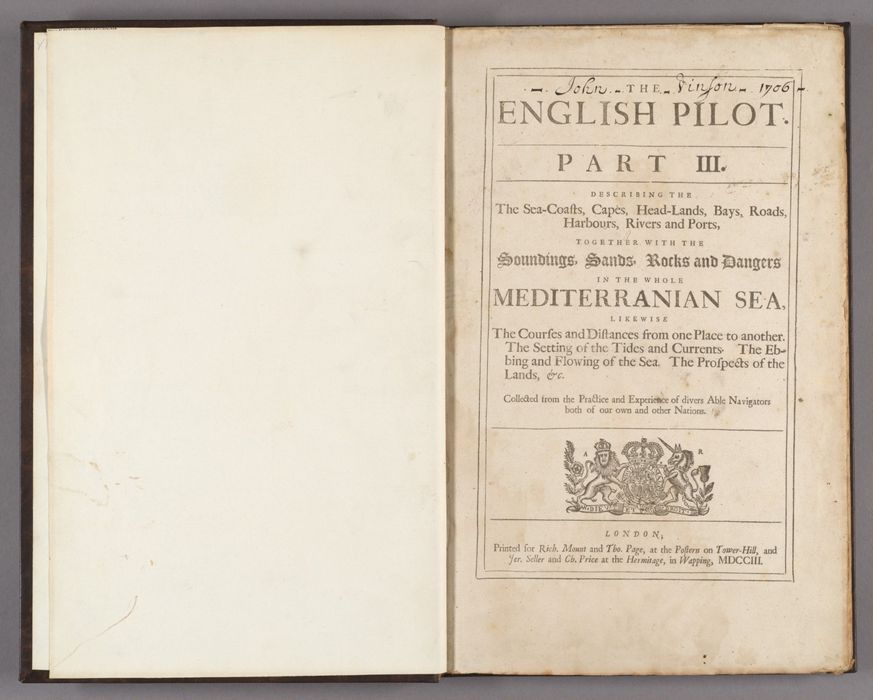
The English pilot : part III, describing the sea-coasts, capes, head-lands, bays, roads, harbours, rivers, and ports : together with the soundings, sands, rocks and dangers in the whole Mediterranian Sea : likewise the courses and distances from one place to another, the setting of the tides and currents, the ebbing and flowing of the sea, the prospects of the lands, &c. : collected from the practice and experience of divers able navigators both of our own and other nations.
Published / Created:
London : Printed for Rich. Mount and Tho. Page, at the Postern on Tower-Hill, and Jer. Seller and Ch. Price at the Hermitage, in Wapping, MDCCIII [1703]
Physical Description:
1 atlas ([2], 92 pages, [37] leaves of plates) : illustrations, maps ; 46 cm
Collection:
Rare Books and Manuscripts
Copyright Status:
Public Domain
Related Content:
View a selection of digital images in the Yale Center for British Art's online catalogue
https://collections.britishart.yale.edu/catalog/orbis:13655340
Classification:
Maps & Atlas (printed)
Scale:
Scales differ.
Notes:
With 19 plates of engraved maps, 18 of which are on double leaves. Also includes maps printed on pages with letterpress text.
Contents:
Plates: [1] A generall chart of the Mediterranean Sea -- [2] A chart of the sea-coast of Spain, from Cape de Gata to Cape S. Martin and of the sea-coast of Barbary, from Cape de Hone to Cape de Tenes / by John Seller -- [3] A chart of the Levant or eastermost part of the Mediterranean Sea / by John Seller -- [4] A chart of the Straits of Gibralter / Joel Gascoyne sculp. -- [5] A chart of the sea-coast of Spain from the straits mouth to C. de Gat and of the sea-coast of Barbary, from the straits mouth to C. de Hone -- [6] The sea coast of Barbary, from Cape de Tenes to Cape de Rosa / by John Seller ; Iames Bennett sculp. -- [7] The sea coast of Valencia and Catalonia from C. S. Martin to C. Dragon, with the Island of Maiorca, Minorca, and Juica -- [8]The Bay of Alfaques near Tortosa in Valencia / drawn by Capt. Doleman in Jan. 1705/6 -- [9] A large chart of Port Maon on the Island Minork in the Meditteranean -- [10] Bay of Toulon. Bay of Marcellia -- [11] The sea coast of Languedoc & Provence and part of Italy, from Cape Dragon to Cape delle Melle / Ia. Bennett sculp. -- [12] The sea coast of the island Sardinia and Corsica / Ia. Bennett sculp. -- [13] The sea coast of Italy, from Cape delle Melle to Mount Argentato, with the island of Corsica / Ia. Bennett sculp. -- [14] A chart of the sea coast of Italy, Sicily, and part of Barbary / Ia. Bennett sculp. -- [15] A sea chart of the Gulph of Venice, describing all the sea coasts and islands contained therein -- [16] A chart of the south part of Cephalonia, with the island of Zante, and the coast of Morea from C. Chiarese to C. Sapienza / J. Gas. sculp. A chart of the south coast of Morea, from Venetica to C. S. Angelo with the islands of Serigo Serigoto and part of Candia -- [17] The sea coast of the island Candia, with all the bayes, havens, and roades on the island and theare about -- [18] A new chart of the Archipelago -- [19] A chart of the Levant or the sea coast of Egypt, Syria, Caramania, and the island Cyprus / by Iohn Seller.
Subject Terms:
Coasts -- Mediterranean Sea. | Navigation -- Mediterranean Sea. | Vinson, John -- Autograph. | Carnegie, G. -- Autograph.
Form/Genre:
Nautical charts. | Atlases. | Pilot guides.
Contributors:
Seller, John, active 1658–1698, cartographer. | Thornton, 1641–1708, cartographer. | Bennett, James, active 1675–1677, engraver. | Gascoyne, Joel, 1650– engraver. | R. Mount and T. Page, publisher.