Search Constraints
You searched for:
Associated Places Isle of Wight (England)
Remove constraint Associated Places: Isle of Wight (England)Work Type map
Remove constraint Work Type: mapSearch Results

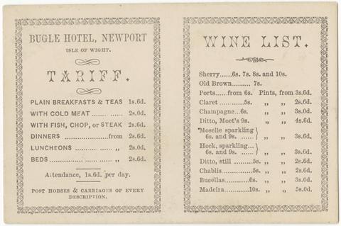
- Date:
- [late 19th century]
- Physical Description:
- 1 tariff card : map ; 76 x 114 mm
- Collection:
- Rare Books and Manuscripts

- Date:
- [1671?]
- Physical Description:
- 1 map : pen and ink and watercolor ; sheet 69 x 80 cm
- Collection:
- Rare Books and Manuscripts

- Date:
- 1591
- Physical Description:
- 1 map : engraving ; 24 x 33 cm, on sheet 29 x 43 cm
- Collection:
- Rare Books and Manuscripts

- Date:
- 1878
- Physical Description:
- x, 366 p., [5] leaves of plates ([4] folded) : ill., maps ; 17 cm.+ [1] folded map (73 x 94 cm, folded to 15 x 10 cm.)
- Collection:
- Rare Books and Manuscripts
- Credit Line:
- Yale Center for British Art, Gift of Elisabeth Fairman

- Date:
- [1671?]
- Physical Description:
- 1 map : pen and ink and watercolor ; sheet 64 x 75 cm
- Collection:
- Rare Books and Manuscripts

- Date:
- [1671?]
- Physical Description:
- 2 maps on 1 sheet : pen and ink and watercolor ; sheet 64 x 76 cm
- Collection:
- Rare Books and Manuscripts

- Date:
- December, 1671
- Physical Description:
- 1 map : pen and ink and watercolor ; sheet 76 x 120 cm
- Collection:
- Rare Books and Manuscripts